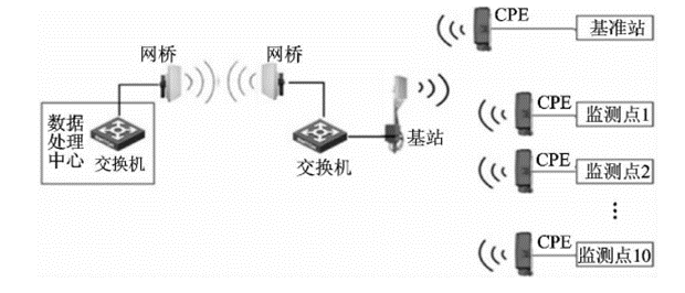
As the demand for geological environment monitoring increases, high-precision surface deformation monitoring technology has become an important means of ensuring engineering safety and geological disaster warning. Addressing the low efficiency of traditional geological subsidence monitoring networks, complex error sources, and insufficient computational accuracy, this project has developed a comprehensive monitoring technology system. It focuses on optimizing three key technologies: monitoring network design, multi-source error correction, and high-precision baseline computation. For error correction, the project innovatively uses the ionospheric NLIM linear interpolation model and the tropospheric global a priori model for atmospheric delay correction, while introducing precise ephemeris to effectively eliminate orbit errors. In the baseline computation phase, a multi-station integrated computation algorithm has been developed, significantly improving data processing accuracy and reliability. The project results show that the developed geological subsidence monitoring system has excellent performance, with 3D measurement accuracy reaching industry-leading levels: the maximum discrete error is controlled within 3mm (CEP/90% confidence), and the standard deviation (mean error) is only 1mm (RMS).

